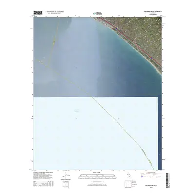
2015 Map of San Onofre Bluff
USGS Topo · Published 2015About this map
The coastal boundary between Orange and San Diego Counties is defined by this coastal corridor, where the land meets the Pacific Ocean. This stretch of Southern California shoreline is characterized by the prominent San Onofre Bluff and the carved terrain of Foley Canyon. Transportation history is layered here along the narrow terrace between the hills and the sea, featuring both the historic El Camino Real and the Old Pacific Hwy. These routes follow the natural contours of the coast, connecting the settlement of Agra to the surrounding region. The map highlights the intersection of modern infrastructure and the geographic constraints of the coastal bluffs, documenting the alignment of the California state border and regional transit links during the mid-2010s.
Find a feature on this map
9 named features on this map. Tap any name to fly to it.
Don’t see what you’re looking for? This feature index may not catch every label — zoom into the map to look around manually.
Map Details
Editions of this 2015 San Onofre Bluff Map
This is the sole edition of this map. No revisions or reprints were ever made.
Other maps of this area

1893 · Oceanside
USGS Topo · 1:62,500

1898 · Oceanside
USGS Topo · 1:62,500

1901 · Oceanside
USGS Topo · 1:62,500

1901 · San Luis Rey
USGS Topo · 1:125,000

1902 · Capistrano
USGS Topo · 1:125,000

1904 · Southern California Sheet No. 2
USGS Topo · 1:250,000

1906 · Capistrano
USGS Topo · 1:125,000

1941 · Margarita Peak
USGS Topo · 1:62,500

1942 · Margarita Peak
USGS Topo · 1:62,500

1942 · San Juan Capistrano
USGS Topo · 1:62,500
Featured Places
- San Clemente, CA
- Marine Corps Base Camp Pendleton, CA
- Agra, Marine Corps Base Camp Pendleton
- San Diego County, CA
- Orange County, CA