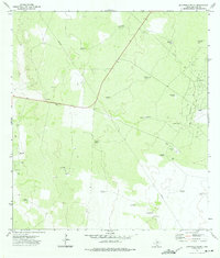
1972 Map of San Pablo Ranch
USGS Topo · Published 1975About this map
San Pablo Ranch and the surrounding South Texas brush country are defined here by a network of water-pumping infrastructure and petroleum exploration. This 1970s landscape in Jim Hogg County is dotted with specific, family-named water sources such as the Pablo Blanco Windmill, Maria Stella Windmill, and Tia Nena Windmill, which reflect the region's essential reliance on groundwater for ranching operations. The industrial character of the era is visible through the Prado Oil Field and numerous scattered Oil Wells, linked by a prominent Pipeline cutting across the terrain. Remote outposts like San Rafael Ranch and Lyton Ranch, the latter featuring a dedicated Landing Strip, highlight the vast distances and specialized transportation required to manage these large-scale holdings during the late twentieth century.
Find a feature on this map
31 named features on this map. Tap any name to fly to it.
Don’t see what you’re looking for? This feature index may not catch every label — zoom into the map to look around manually.
Map Details
Editions of this 1972 San Pablo Ranch Map
This is the sole edition of this map. No revisions or reprints were ever made.
Other maps of this area

1938 · Agua Nueva
USGS Topo · 1:62,500

1938 · Cuevitas
USGS Topo · 1:62,500

1939 · Randado
USGS Topo · 1:62,500

1940 · Randado
USGS Topo · 1:62,500

1949 · Mc Allen
USGS Topo · 1:250,000

1954 · McAllen
USGS Topo · 1:250,000

1956 · Laredo
USGS Topo · 1:250,000

1957 · Mc Allen
USGS Topo · 1:250,000

1962 · McAllen
USGS Topo · 1:250,000

1972 · Armstrong Ranch
USGS Topo · 1:24,000