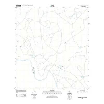
2010 Map of San Pedro Hill
USGS Topo · Published 2010About this map
The Rio Grande serves as the international boundary between the United States of America and Estados Unidos Mexicanos along this brushy stretch of Webb County. The landscape is defined by the ranching heritage of South Texas, with large landholdings such as Miller Ranch, Alexander Ranch, and La Mesa Ranch scattered across the arid terrain. The settlement of Palafox sits near the river's edge, while the interior is navigated via Mines Rd and Ranch Rd 1472. Water management is critical in this environment, evidenced by the presence of La Mesa Lake Dam and the isolated Johnson Waterhole Number One. Rising above the surrounding plains, the namesake San Pedro Hill provides a prominent natural landmark in a region where seasonal drainages like Carricitos Creek carve through the earth toward the border.
Find a feature on this map
15 named features on this map. Tap any name to fly to it.
Don’t see what you’re looking for? This feature index may not catch every label — zoom into the map to look around manually.
Map Details
Editions of this 2010 San Pedro Hill Map
This is the sole edition of this map. No revisions or reprints were ever made.
Other maps of this area

1923 · Palafox
USGS Topo · 1:62,500

1956 · Las Tiendas
USGS Topo · 1:62,500

1956 · Islitas
USGS Topo · 1:62,500

1956 · Laredo
USGS Topo · 1:250,000

1965 · Cerritos Blancos
USGS Topo · 1:24,000
1965 · Dolores Ranch
USGS Topo · 1:24,000
1965 · Las Tiendas
USGS Topo · 1:24,000
1982 · Pinto Creek
USGS Topo · 1:24,000
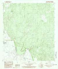
1983 · San Pedro Hill
USGS Topo · 1:24,000
1983 · Palafox SW
USGS Topo · 1:24,000