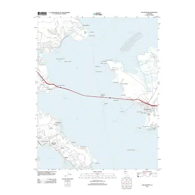
2012 Map of San Quentin
USGS Topo · Published 2012About this map
The Richmond - San Rafael Bridge spans the narrowest point of the North Bay, anchoring a maritime and industrial landscape that connects Marin and Contra Costa counties. This survey documents the complex interface of deep-water shipping channels and residential peninsulas, where the Southampton Shoal Channel guides vessels past the historic East Brother Lighthouse. The map details the transition from the industrial waterfronts of Point Richmond, featuring the Long Wharf and Brickyard Cove Marina, to the suburban enclaves of the Tiburon Peninsula and Bel Aire.
Find a feature on this map
56 named features on this map. Tap any name to fly to it.
Don’t see what you’re looking for? This feature index may not catch every label — zoom into the map to look around manually.
Map Details
Editions of this 2012 San Quentin Map
This is the sole edition of this map. No revisions or reprints were ever made.
Other maps of this area

1895 · San Francisco
USGS Topo · 1:62,500

1897 · Tamalpais
USGS Topo · 1:62,500

1899 · San Francisco
USGS Topo · 1:62,500

1902 · Napa
USGS Topo · 1:125,000

1914 · Petaluma
USGS Topo · 1:62,500

1915 · San Francisco
USGS Topo · 1:62,500

1916 · Mare Island
USGS Topo · 1:62,500

1941 · Tamalpais
USGS Topo · 1:62,500

1942 · Mare Island
USGS Topo · 1:62,500

1942 · Petaluma
USGS Topo · 1:62,500