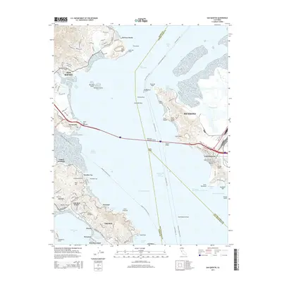
2015 Map of San Quentin
USGS Topo · Published 2015About this map
Tiburon and the Tiburon Peninsula extend into the northern reaches of San Francisco Bay, defining a landscape where maritime transport and residential development converge. This modern survey illustrates the complex ferry networks including the Vallejo-San Francisco Fry and the Larkspur-San Francisco Fry that crisscross the San Pablo Strait. The massive span of the Richmond-San Rafael Bridge serves as a central artery connecting San Rafael with the industrial and residential hubs of Richmond.
Find a feature on this map
71 named features on this map. Tap any name to fly to it.
Don’t see what you’re looking for? This feature index may not catch every label — zoom into the map to look around manually.
Map Details
Editions of this 2015 San Quentin Map
This is the sole edition of this map. No revisions or reprints were ever made.
Other maps of this area

1895 · San Francisco
USGS Topo · 1:62,500

1897 · Tamalpais
USGS Topo · 1:62,500

1899 · San Francisco
USGS Topo · 1:62,500

1902 · Napa
USGS Topo · 1:125,000

1914 · Petaluma
USGS Topo · 1:62,500

1915 · San Francisco
USGS Topo · 1:62,500

1916 · Mare Island
USGS Topo · 1:62,500

1941 · Tamalpais
USGS Topo · 1:62,500

1942 · Mare Island
USGS Topo · 1:62,500

1942 · Petaluma
USGS Topo · 1:62,500