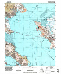
1993 Map of San Quentin
USGS Topo · Published 1997About this map
San Quentin State Prison and the industrial waterfront of Richmond anchor this 1993 study of the San Francisco Bay's northern reaches. The landscape is defined by the heavy infrastructure of the era, including the Naval Fuel Supply Depot and the extensive Long Wharf at Point Richmond. These industrial sites contrast sharply with the conserved lands of China Camp State Park and the Tiburon Uplands Nature Preserve, illustrating the complex land-use patterns of the late 20th century.
Find a feature on this map
68 named features on this map. Tap any name to fly to it.
Don’t see what you’re looking for? This feature index may not catch every label — zoom into the map to look around manually.
Map Details
Editions of this 1993 San Quentin Map
This is the sole edition of this map. No revisions or reprints were ever made.
Other maps of this area

1895 · San Francisco
USGS Topo · 1:62,500

1897 · Tamalpais
USGS Topo · 1:62,500

1899 · San Francisco
USGS Topo · 1:62,500

1902 · Napa
USGS Topo · 1:125,000

1914 · Petaluma
USGS Topo · 1:62,500

1915 · San Francisco
USGS Topo · 1:62,500

1916 · Mare Island
USGS Topo · 1:62,500

1941 · Tamalpais
USGS Topo · 1:62,500

1942 · Mare Island
USGS Topo · 1:62,500

1942 · Petaluma
USGS Topo · 1:62,500