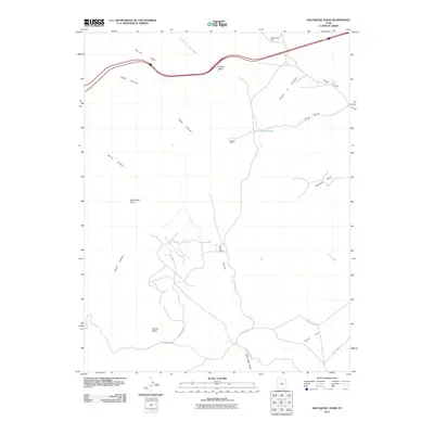
2011 Map of San Rafael Knob
USGS Topo · Published 2011About this map
San Rafael Knob rises as a prominent landmark in this desert landscape of the San Rafael Swell, documented in the early 21st century. The terrain is defined by a series of deep drainages and canyons, including Devils Canyon, Reds Canyon, and Eagle Canyon, which carve through the high plateaus. Evidence of human presence and historical ranching activity is found at Swasey Cabin, located near the Forked Post Pond. The map reveals a complex network of unpaved tracks and historical routes, such as the Red Canyon Loop and Temple Mt Rd, which provide access through the secluded Rods Valley. Geological features like Dutchman Arch and Ghost Rock highlight the erosion-carved environment, while locations such as Tan Seep indicate the vital and scarce water sources in this arid stretch of Emery County.
Find a feature on this map
24 named features on this map. Tap any name to fly to it.
Don’t see what you’re looking for? This feature index may not catch every label — zoom into the map to look around manually.
Map Details
Editions of this 2011 San Rafael Knob Map
This is the sole edition of this map. No revisions or reprints were ever made.
Other maps of this area

1885 · San Rafael
USGS Topo · 1:250,000

1952 · Wild Horse
USGS Topo · 1:62,500

1952 · San Rafael Knob
USGS Topo · 1:62,500

1953 · Stinking Spring Creek 2 SE
USGS Topo · 1:24,000

1953 · Temple Mtn
USGS Topo · 1:62,500

1954 · Stinking Spring Creek 1 NW
USGS Topo · 1:24,000

1954 · Stinking Spring Creek 3 NW
USGS Topo · 1:24,000

1954 · Stinking Spring Creek 4 NW
USGS Topo · 1:24,000

1954 · Stinking Spring Creek 2 SW
USGS Topo · 1:24,000

1954 · Stinking Spring Creek 2 NE
USGS Topo · 1:24,000