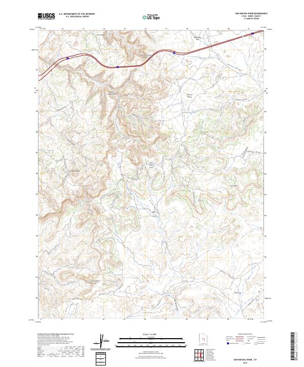
2023 Map of San Rafael Knob
USGS Topo · Published 2023About this map
San Rafael Knob rises as a prominent landmark in this segment of the San Rafael Swell, a geologic landscape defined by deep canyons and flat-topped mesas. The modern passage of I-70 bisects the northern reaches, following a route past Dutchman Arch and across the South Fork Coal Wash. Below the highway, a network of tracks like the Rod's Valley Cutoff and Red Canyon Loop suggests the persistent human presence of ranchers and explorers navigating the drainages between Secret Mesa and Taylor Flat.
Find a feature on this map
37 named features on this map. Tap any name to fly to it.
Don’t see what you’re looking for? This feature index may not catch every label — zoom into the map to look around manually.
Map Details
Editions of this 2023 San Rafael Knob Map
This is the sole edition of this map. No revisions or reprints were ever made.
Other maps of this area

1885 · San Rafael
USGS Topo · 1:250,000

1952 · Wild Horse
USGS Topo · 1:62,500

1952 · San Rafael Knob
USGS Topo · 1:62,500

1953 · Stinking Spring Creek 2 SE
USGS Topo · 1:24,000

1953 · Temple Mtn
USGS Topo · 1:62,500

1954 · Stinking Spring Creek 1 NW
USGS Topo · 1:24,000

1954 · Stinking Spring Creek 3 NW
USGS Topo · 1:24,000

1954 · Stinking Spring Creek 4 NW
USGS Topo · 1:24,000

1954 · Stinking Spring Creek 2 SW
USGS Topo · 1:24,000

1954 · Stinking Spring Creek 2 NE
USGS Topo · 1:24,000