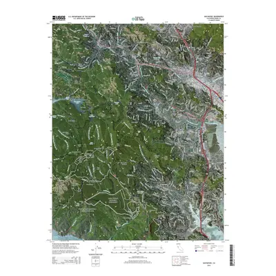
2015 Map of San Rafael
USGS Topo · Published 2015About this map
Muir Woods National Monument and the Golden Gate National Recreation Area dominate the southwestern portion of this coastal Marin County landscape. The terrain rises sharply from the shoreline at Richardson Bay toward the heights of Mt Tamalpais Peak, with the notable Double Bowknot formation visible on the mountain's eastern slopes. The map traces the dense network of suburban development through the valleys, connecting settlements like San Rafael, Mill Valley, and Corte Madera. Along the northern edge, educational and community landmarks such as the Dominican Univ of California and Mount Tamalpais Cemetery serve as historical anchors for the surrounding neighborhoods of Sun Valley and San Anselmo. Infrastructure including Forbes Hill Reservoir and the winding course of Corte Madera Creek highlights the engineering required to support these hillside communities.
Find a feature on this map
106 named features on this map. Tap any name to fly to it.
Don’t see what you’re looking for? This feature index may not catch every label — zoom into the map to look around manually.
Map Details
Editions of this 2015 San Rafael Map
This is the sole edition of this map. No revisions or reprints were ever made.
Other maps of this area

1895 · San Francisco
USGS Topo · 1:62,500

1897 · Tamalpais
USGS Topo · 1:62,500

1899 · San Francisco
USGS Topo · 1:62,500

1902 · Napa
USGS Topo · 1:125,000

1914 · Petaluma
USGS Topo · 1:62,500

1915 · San Francisco
USGS Topo · 1:62,500

1916 · Mare Island
USGS Topo · 1:62,500

1941 · Tamalpais
USGS Topo · 1:62,500

1942 · Mare Island
USGS Topo · 1:62,500

1942 · Petaluma
USGS Topo · 1:62,500