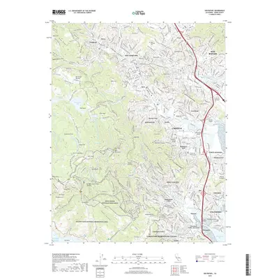
2018 Map of San Rafael
USGS Topo · Published 2018About this map
Muir Woods National Monument and the steep slopes of Mt Tamalpais dominate the southwestern portion of this Marin County landscape, where deep canyons like Redwood Canyon and Kent Canyon reveal the complex topography that constrained early development. Residential clusters including San Anselmo, Fairfax, and Ross are concentrated in the flatter valleys and along the winding courses of San Anselmo Creek and Corte Madera Creek. The map documents a sophisticated network of fire roads and trails, such as Eldridge Grade and Hoo-Koo-E-Koo Road, which navigate the high ridges and peaks including East Peak and West Peak. To the east, the urban fabric of San Rafael meets the water at the San Rafael Yacht Harbor, while several important reservoirs like Phoenix Lake and Bon Tempe Lake illustrate the vital role of the watershed in this densely settled peninsula.
Find a feature on this map
184 named features on this map. Tap any name to fly to it.
Don’t see what you’re looking for? This feature index may not catch every label — zoom into the map to look around manually.
Map Details
Editions of this 2018 San Rafael Map
This is the sole edition of this map. No revisions or reprints were ever made.
Other maps of this area

1895 · San Francisco
USGS Topo · 1:62,500

1897 · Tamalpais
USGS Topo · 1:62,500

1899 · San Francisco
USGS Topo · 1:62,500

1902 · Napa
USGS Topo · 1:125,000

1914 · Petaluma
USGS Topo · 1:62,500

1915 · San Francisco
USGS Topo · 1:62,500

1916 · Mare Island
USGS Topo · 1:62,500

1941 · Tamalpais
USGS Topo · 1:62,500

1942 · Mare Island
USGS Topo · 1:62,500

1942 · Petaluma
USGS Topo · 1:62,500