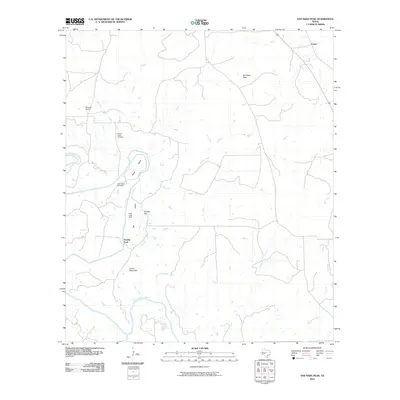
2010 Map of San Saba Peak
USGS Topo · Published 2010About this map
San Saba Peak and Green Mountain dominate the local topography north of a broad bend in the Colorado River during this 2010 survey of Mills County. The landscape is defined by the river’s winding course and its many tributaries, including Nabors Creek, Shaw Creek, and Elliott Creek. Human presence is marked by scattered markers of local history such as the Nabors Creek Cemetery and Shaw Bend Cemetery, alongside the small settlement of Castor in the northeast. The presence of Edwards Airport and Double Ford indicates the region’s reliance on both modern and traditional transit points across the rugged Texas terrain. Water management is evident at Dyer Lake Dam, while names like Vinegar Hill and Rye Valley provide character to the rural ranching and farming lands characteristic of this part of Central Texas.
Find a feature on this map
22 named features on this map. Tap any name to fly to it.
Don’t see what you’re looking for? This feature index may not catch every label — zoom into the map to look around manually.
Map Details
Editions of this 2010 San Saba Peak Map
This is the sole edition of this map. No revisions or reprints were ever made.
Other maps of this area

1885 · San Saba
USGS Topo · 1:125,000

1887 · Lampasas
USGS Topo · 1:125,000

1894 · Lampasas
USGS Topo · 1:125,000

1894 · San Saba
USGS Topo · 1:125,000

1925 · San Saba 4-a
USGS Topo · 1:48,000

1925 · San Saba 1-c
USGS Topo · 1:48,000

1925 · San Saba 1-b
USGS Topo · 1:48,000

1925 · San Saba 1-d
USGS Topo · 1:48,000

1928 · Goldthwaite
USGS Topo · 1:62,500

1931 · Bend
USGS Topo · 1:62,500