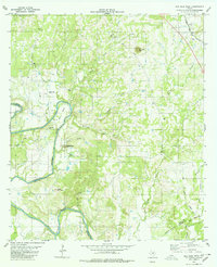
1980 Map of San Saba Peak
USGS Topo · Published 1980About this map
The Colorado River carves a winding path through the heart of this Central Texas landscape, defining the jagged boundaries between San Saba and Mills counties. The river's influence is evident at Shaw Bend, where the water loops around Rye Valley and past Vinegar Hill. This 1980 survey captures a rural terrain of named heights and spring-fed creeks, anchored by the prominent San Saba Peak and Green Mountain.
Find a feature on this map
25 named features on this map. Tap any name to fly to it.
Don’t see what you’re looking for? This feature index may not catch every label — zoom into the map to look around manually.
Map Details
Editions of this 1980 San Saba Peak Map
This is the sole edition of this map. No revisions or reprints were ever made.
Other maps of this area

1885 · San Saba
USGS Topo · 1:125,000

1887 · Lampasas
USGS Topo · 1:125,000

1894 · Lampasas
USGS Topo · 1:125,000

1894 · San Saba
USGS Topo · 1:125,000

1925 · San Saba 4-a
USGS Topo · 1:48,000

1925 · San Saba 1-c
USGS Topo · 1:48,000

1925 · San Saba 1-b
USGS Topo · 1:48,000

1925 · San Saba 1-d
USGS Topo · 1:48,000

1928 · Goldthwaite
USGS Topo · 1:62,500

1931 · Bend
USGS Topo · 1:62,500