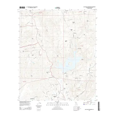
2015 Map of San Vicente Reservoir
USGS Topo · Published 2015About this map
San Vicente Reservoir dominates this central San Diego County landscape, where the water's edge meets the steep canyons of the Peninsular Ranges. The map captures the complex water infrastructure of the region, featuring the San Diego Aqueduct as it traverses the terrain toward the reservoir. To the south, the suburban expansion of Santee and Eucalyptus Hills is clearly visible, showing a network of residential roads like Eucalyptus Hills Dr and Rocoso Rd pushing into the foothills.
Find a feature on this map
90 named features on this map. Tap any name to fly to it.
Don’t see what you’re looking for? This feature index may not catch every label — zoom into the map to look around manually.
Map Details
Editions of this 2015 San Vicente Reservoir Map
This is the sole edition of this map. No revisions or reprints were ever made.
Other maps of this area

1893 · El Cajon
USGS Topo · 1:62,500

1893 · Escondido
USGS Topo · 1:62,500

1901 · Elcajon
USGS Topo · 1:62,500

1901 · Escondido
USGS Topo · 1:62,500

1901 · San Luis Rey
USGS Topo · 1:125,000

1903 · Cuyamaca
USGS Topo · 1:125,000

1903 · La Jolla
USGS Topo · 1:62,500

1903 · Elcajon
USGS Topo · 1:62,500

1903 · Ramona
USGS Topo · 1:125,000

1904 · Southern California Sheet No. 2
USGS Topo · 1:250,000