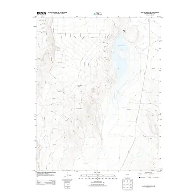
2013 Map of Sanchez Reservoir
USGS Topo · Published 2013About this map
Sanchez Reservoir dominates the high-altitude landscape of Costilla County, serving as a focal point for the surrounding network of intermittent creeks and irrigation infrastructure. The eastern shore is characterized by a developing grid of residential roads such as Vista Dr and Lakewood Trl, while the western terrain rises sharply toward the prominent San Pedro Mesa. This 2013 topographic survey captures the area's transition into a modern rural subdivision, where the Melby Ranch Airstrip provides a remote point of access. The hydrology of the Culebra Creek watershed is visible through the intricate paths of Ventero Cr, Jaroso Cr, and the Sanchez Canal, illustrating the complex management of water in this arid Colorado environment.
Find a feature on this map
66 named features on this map. Tap any name to fly to it.
Don’t see what you’re looking for? This feature index may not catch every label — zoom into the map to look around manually.
Map Details
Editions of this 2013 Sanchez Reservoir Map
This is the sole edition of this map. No revisions or reprints were ever made.
Other maps of this area

1954 · Raton
USGS Topo · 1:250,000

1954 · Trinidad
USGS Topo · 1:250,000

1955 · Trinidad
USGS Topo · 1:250,000

1958 · Raton
USGS Topo · 1:250,000

1958 · Trinidad
USGS Topo · 1:250,000

1959 · Trinidad
USGS Topo · 1:250,000

1963 · Costilla
USGS Topo · 1:24,000

1963 · Amalia
USGS Topo · 1:24,000

1963 · Big Costilla Peak
USGS Topo · 1:24,000

1967 · San Luis
USGS Topo · 1:24,000