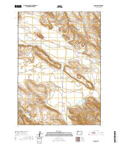
2020 Map of Sand Gap
USGS Topo · Published 2020About this map
Virginia Valley and Anderson Valley characterize this high-desert region of Harney County, where the hydrological system centers on the S Fork Malheur River. The landscape is defined by its water management for ranching and agriculture, evidenced by several water bodies including Mahon Reservoir and Jenkins Reservoir. Notable topographic landmarks such as Round Mtn and the uniquely named Hole in the Ground provide distinct navigational points in an area otherwise marked by subtle shifts in elevation. The infrastructure of the quadrangle follows these natural corridors, with Crane Blvd and the Old Hwy tracing the valley floors. Smaller drainage systems like Camp Cr, Stonehill Cr, and Buster Cr feed into the larger river system, illustrating the complex seasonal water flow through the Sand Gap pass.
Find a feature on this map
18 named features on this map. Tap any name to fly to it.
Don’t see what you’re looking for? This feature index may not catch every label — zoom into the map to look around manually.
Map Details
Editions of this 2020 Sand Gap Map
This is the sole edition of this map. No revisions or reprints were ever made.
Other maps of this area

1955 · Burns
USGS Topo · 1:250,000

1958 · Burns
USGS Topo · 1:250,000

1959 · Burns
USGS Topo · 1:250,000

1960 · Crane
USGS Topo · 1:62,500

1967 · Happy Valley
USGS Topo · 1:24,000

1967 · Adobe Flat
USGS Topo · 1:24,000

1968 · Venator
USGS Topo · 1:62,500

1972 · Circle Bar
USGS Topo · 1:24,000

1972 · Venator
USGS Topo · 1:24,000

1974 · Anderson Mtn
USGS Topo · 1:62,500