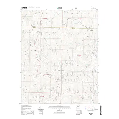
2014 Map of Sand Gap
USGS Topo · Published 2014About this map
Freeman Springs and Sand Gap anchor this high-elevation portion of the Ozark National Forest at the boundary of Newton and Pope Counties. The landscape is defined by the headwaters of several drainage systems, including the N Fork Illinois Bayou and Richland Cr. Deeply incised hollows like Boss Hollow and Still Hollow separate prominent high points such as Sollys Knob, Burgiss Knob, and the curiously named Dare Mine Knob. The presence of the Fairview Fire Tower atop a ridge near the intersection of State Hwy 7 and State Hwy 123 highlights the forest management priorities of the region. Local heritage is preserved in several small burial grounds, including Richland Cem and Freeman Springs Cem, which serve as quiet markers of the families who settled this dissected plateau. Notable geological formations like Pedestal Rocks and Arch Rock appear in the eastern sections, indicating the unique erosion patterns of the Ozark sandstone.
Find a feature on this map
48 named features on this map. Tap any name to fly to it.
Don’t see what you’re looking for? This feature index may not catch every label — zoom into the map to look around manually.
Map Details
Editions of this 2014 Sand Gap Map
This is the sole edition of this map. No revisions or reprints were ever made.
Other maps of this area

1879 · Washington
USGS Topo · 1:62,500

1887 · Smyrna
USGS Topo · 1:62,500

1889 · Treat
USGS Topo · 1:62,500

1889 · Marshall #3
USGS Topo · 1:62,500

1892 · Marshall
USGS Topo · 1:125,000

1894 · Marshall
USGS Topo · 1:125,000

1901 · Marshall
USGS Topo · 1:125,000

1932 · Treat
USGS Topo · 1:62,500

1933 · Mt Judea
USGS Topo · 1:62,500

1934 · Treat
USGS Topo · 1:62,500