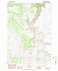
1983 Map of Sand Hollow
USGS Topo · Published 1983About this map
The South Fork Crooked River carves a deep path through the High Desert of Crook County in the early 1980s, revealing a landscape defined by seasonal water and cattle ranching. The presence of Cold Spring Ranch, Sherman Ranch, and Lower Sherman Ranch illustrates the importance of riparian corridors for settlement in this arid region. High above the river valley, the terrain shifts to dramatic flats like Twelvemile Table and prominent ridges such as Steens Ridge, where essential infrastructure for livestock is marked by the Divide Waterhole and Furnace Waterhole. The ephemeral nature of the local hydrology is evident in the numerous dry lakebeds, including Daguis Lake (Dry) and Lillard Lake (Dry). This survey captures the specialized land use of the Oregon interior, where 4wd tracks and canyons like Sheep Head Canyon provide the only access through the rimrock and sagebrush.
Find a feature on this map
27 named features on this map. Tap any name to fly to it.
Don’t see what you’re looking for? This feature index may not catch every label — zoom into the map to look around manually.
Map Details
Editions of this 1983 Sand Hollow Map
This is the sole edition of this map. No revisions or reprints were ever made.
Other maps of this area

1932 · Dayville
USGS Topo · 1:125,000

1936 · Dayville
USGS Topo · 1:125,000

1955 · Crescent
USGS Topo · 1:250,000

1955 · Bend
USGS Topo · 1:250,000

1955 · Burns
USGS Topo · 1:250,000

1955 · Canyon City
USGS Topo · 1:250,000

1957 · Crescent
USGS Topo · 1:250,000

1957 · Bend
USGS Topo · 1:250,000

1958 · Crescent
USGS Topo · 1:250,000

1958 · Burns
USGS Topo · 1:250,000