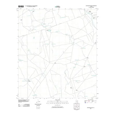
2010 Map of Sand Mountain
USGS Topo · Published 2010About this map
The Nueces River winds through the northeast corner of this Uvalde County landscape, defining the crossing at Smyth Crossing where it meets Ranch Rd 481. This ranching country is characterized by an extensive network of water management features, including Smyth Lake, Big Maverick Lake, and numerous stock tanks such as Linney Tanks and Cow Camp Tank. The terrain is punctuated by significant landmarks like Wagon Top and Sand Mountain, which rise above the drainages of Mustang Creek, Turkey Creek, and Maverick Creek. Family-named operations such as Barkly Ranch, Weirbush Ranch, and Lyles Ranch are scattered across the quadrangle, connected by a web of service roads and marked by essential infrastructure like the Kieffer Windmill and West Windmill. This map documents a specialized ranching economy reliant on carefully managed water resources in a semi-arid Texas environment.
Find a feature on this map
44 named features on this map. Tap any name to fly to it.
Don’t see what you’re looking for? This feature index may not catch every label — zoom into the map to look around manually.
Map Details
Editions of this 2010 Sand Mountain Map
This is the sole edition of this map. No revisions or reprints were ever made.
Other maps of this area

1896 · Brackett
USGS Topo · 1:125,000

1897 · Brackett
USGS Topo · 1:125,000

1898 · Uvalde
USGS Topo · 1:125,000

1899 · Uvalde
USGS Topo · 1:125,000

1939 · La Pryor
USGS Topo · 1:62,500

1940 · Chacon Creek
USGS Topo · 1:62,500

1949 · Cline
USGS Topo · 1:62,500

1953 · Crystal City
USGS Topo · 1:250,000

1954 · San Antonio
USGS Topo · 1:250,000

1955 · Crystal City
USGS Topo · 1:250,000