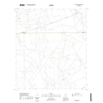
2019 Map of Sand Mountain
USGS Topo · Published 2019About this map
The Nueces River winds through the northeast corner of this arid landscape, which straddles the boundary between Uvalde Co and Zavala Co. The terrain is characterized by a complex network of seasonal drainage systems, including Maverick Cr, Turkey Cr, and Mustang Cr, all of which converge toward the river basin. Rising above the brushland is Sand Mtn, a prominent topographic landmark in the southern section of the quadrangle.
Find a feature on this map
33 named features on this map. Tap any name to fly to it.
Don’t see what you’re looking for? This feature index may not catch every label — zoom into the map to look around manually.
Map Details
Editions of this 2019 Sand Mountain Map
This is the sole edition of this map. No revisions or reprints were ever made.
Other maps of this area

1896 · Brackett
USGS Topo · 1:125,000

1897 · Brackett
USGS Topo · 1:125,000

1898 · Uvalde
USGS Topo · 1:125,000

1899 · Uvalde
USGS Topo · 1:125,000

1939 · La Pryor
USGS Topo · 1:62,500

1940 · Chacon Creek
USGS Topo · 1:62,500

1949 · Cline
USGS Topo · 1:62,500

1953 · Crystal City
USGS Topo · 1:250,000

1954 · San Antonio
USGS Topo · 1:250,000

1955 · Crystal City
USGS Topo · 1:250,000