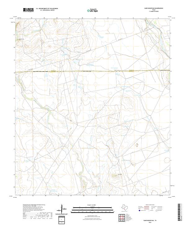
2022 Map of Sand Mountain
USGS Topo · Published 2022About this map
The border of Uvalde Co and Zavala Co runs through this section of the Texas Brush Country, a landscape defined by an extensive system of intermittent creeks and ranching infrastructure. Ranch Rd 481 serves as the primary artery through the territory, crossing drainage basins such as Turkey Cr, Windmill Cr, and Maverick Cr. The prominent rise of Sand Mtn stands as a focal point south of the county line, while Wagon Top anchors the northwestern corner near Wood Slough.
Find a feature on this map
34 named features on this map. Tap any name to fly to it.
Don’t see what you’re looking for? This feature index may not catch every label — zoom into the map to look around manually.
Map Details
Editions of this 2022 Sand Mountain Map
This is the sole edition of this map. No revisions or reprints were ever made.
Other maps of this area

1896 · Brackett
USGS Topo · 1:125,000

1897 · Brackett
USGS Topo · 1:125,000

1898 · Uvalde
USGS Topo · 1:125,000

1899 · Uvalde
USGS Topo · 1:125,000

1939 · La Pryor
USGS Topo · 1:62,500

1940 · Chacon Creek
USGS Topo · 1:62,500

1949 · Cline
USGS Topo · 1:62,500

1953 · Crystal City
USGS Topo · 1:250,000

1954 · San Antonio
USGS Topo · 1:250,000

1955 · Crystal City
USGS Topo · 1:250,000