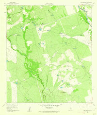
1960 Map of Sand Mountain
USGS Topo · Published 1962About this map
The Nueces River carves through the northeast corner of this 1960 landscape, where the Smyth Crossing provided a key river passage near the Anthon Ranch and Barkly Ranch. This South Texas terrain is defined by a ranching and railroad economy, with the Missouri Pacific railroad line cutting diagonally across the brushland. Dozens of man-made water sources, such as Mustang Tank, Cow Camp Tank, and Railroad Tank, illustrate the critical infrastructure required for livestock in this semi-arid region. Prominent landmarks like Wagon Top and Sand Mountain rise above the drainage systems of Mustang Creek and Turkey Creek. The map also reveals the operational layout of the era with features like the Smyth Station, various windmills including the Kieffer Windmill, and a dedicated Landing Area for light aircraft.
Find a feature on this map
45 named features on this map. Tap any name to fly to it.
Don’t see what you’re looking for? This feature index may not catch every label — zoom into the map to look around manually.
Map Details
Editions of this 1960 Sand Mountain Map
This is the sole edition of this map. No revisions or reprints were ever made.
Other maps of this area

1896 · Brackett
USGS Topo · 1:125,000

1897 · Brackett
USGS Topo · 1:125,000

1898 · Uvalde
USGS Topo · 1:125,000

1899 · Uvalde
USGS Topo · 1:125,000

1939 · La Pryor
USGS Topo · 1:62,500

1940 · Chacon Creek
USGS Topo · 1:62,500

1949 · Cline
USGS Topo · 1:62,500

1953 · Crystal City
USGS Topo · 1:250,000

1954 · San Antonio
USGS Topo · 1:250,000

1955 · Crystal City
USGS Topo · 1:250,000