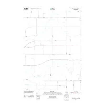
2013 Map of Sand Spring Creek
USGS Topo · Published 2013About this map
The Fox River meanders across this rural section of Columbia County, Wisconsin, defining the local drainage patterns long before the modern road grid took shape. This agricultural landscape is etched with small waterways like Sand Spring Cr and the North Branch Duck Creek, which serve as the primary topographical breaks in the prairie. The settlement of Ingle stands near the northeastern corner, a quiet point in a region dominated by family-named thoroughfares.
Find a feature on this map
39 named features on this map. Tap any name to fly to it.
Don’t see what you’re looking for? This feature index may not catch every label — zoom into the map to look around manually.
Map Details
Editions of this 2013 Sand Spring Creek Map
This is the sole edition of this map. No revisions or reprints were ever made.
Other maps of this area

1901 · Poynette
USGS Topo · 1:62,500

1902 · Portage
USGS Topo · 1:62,500

1955 · Randolph
USGS Topo · 1:62,500

1955 · Columbus
USGS Topo · 1:62,500

1957 · Madison
USGS Topo · 1:250,000

1960 · Madison
USGS Topo · 1:250,000

1962 · Poynette
USGS Topo · 1:62,500

1962 · Portage
USGS Topo · 1:62,500
1980 · Manchester
USGS Topo · 1:24,000
1980 · Rio
USGS Topo · 1:24,000