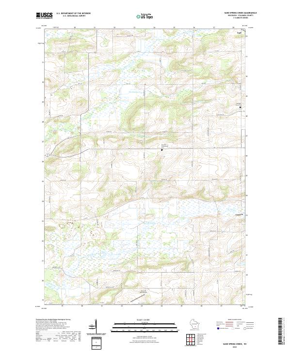
2022 Map of Sand Spring Creek
USGS Topo · Published 2022About this map
Cambria and the small community of Ingle anchor this portion of Columbia County, where a complex network of wetlands and streams defines the rural landscape. The northern reaches are dominated by the winding course of the Fox River, while the southern half of the sheet is characterized by the expansive wetlands surrounding the North Branch Duck Creek and its various tributaries. This 2022 survey illustrates a landscape of established agricultural tradition, marked by long-standing township roads like Welsh Prairie Rd and Friesland Rd. Local genealogy is preserved at the Portage Prairie Cem and Rosedale Presbyterian Cem, which stand as significant landmarks alongside the Bancroft East Airport. The map traces the natural drainage patterns of the Sand Spring Cr as it feeds into the regional river system, providing a detailed look at the rural intersections and land divisions of the early 21st century.
Find a feature on this map
52 named features on this map. Tap any name to fly to it.
Don’t see what you’re looking for? This feature index may not catch every label — zoom into the map to look around manually.
Map Details
Editions of this 2022 Sand Spring Creek Map
This is the sole edition of this map. No revisions or reprints were ever made.
Other maps of this area

1901 · Poynette
USGS Topo · 1:62,500

1902 · Portage
USGS Topo · 1:62,500

1955 · Randolph
USGS Topo · 1:62,500

1955 · Columbus
USGS Topo · 1:62,500

1957 · Madison
USGS Topo · 1:250,000

1960 · Madison
USGS Topo · 1:250,000

1962 · Poynette
USGS Topo · 1:62,500

1962 · Portage
USGS Topo · 1:62,500
1980 · Manchester
USGS Topo · 1:24,000
1980 · Rio
USGS Topo · 1:24,000