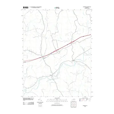
2010 Map of Sanders
USGS Topo · Published 2010About this map
Sanders and Sparta occupy the valley floor along Eagle Creek, where the waterway meanders through the central terrain. This landscape is defined by its intricate drainage network, with numerous named branches and creeks including Lick Creek, Twomile Creek, and Goose Creek feeding into the main valley. The settlement pattern follows the contours of these watercourses and the established road system, with Carson situated to the northwest and residential clusters lining paths such as New Liberty-Sparta Rd. The mapping of small tributaries like Vera Cruz Branch and Tanbark Branch illustrates the dissected nature of the local geography. High-speed transportation routes cut across the drainage basins, creating a distinct contrast between the winding creek-side roads and the direct path of the modern interstate system passing near Lost Branch.
Find a feature on this map
33 named features on this map. Tap any name to fly to it.
Don’t see what you’re looking for? This feature index may not catch every label — zoom into the map to look around manually.
Map Details
Editions of this 2010 Sanders Map
This is the sole edition of this map. No revisions or reprints were ever made.
Other maps of this area

1943 · Florence
USGS Topo · 1:24,000

1943 · Vevay North
USGS Topo · 1:24,000

1943 · Patriot
USGS Topo · 1:24,000

1943 · Vevay South
USGS Topo · 1:24,000

1950 · New Liberty
USGS Topo · 1:24,000

1950 · Glencoe
USGS Topo · 1:24,000

1950 · Owenton
USGS Topo · 1:24,000

1951 · Florence
USGS Topo · 1:24,000

1951 · Sanders
USGS Topo · 1:24,000
1951 · Patriot
USGS Topo · 1:24,000