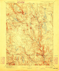
1907 Map of Sandisfield
USGS Topo · Published 1910About this map
Farmington River and its various tributaries, including the Clam River and Buck River, dictate the settlement patterns across this New England borderland. The topography is dominated by numerous named summits like Hunger Mt and Seymour Mt, which separate small villages and hamlets. The massive Otis Reservoir serves as a central landmark, surrounded by smaller bodies of water such as Lake Garfield and White Lily Pond. This 1886 survey, updated for 1910, reflects a landscape of dispersed agricultural and early industrial communities connected by winding valley roads like Larkum Road. In the south, the Massachusetts-Connecticut boundary line cuts across the terrain near North Colebrook and West Norfolk, marking a region where local economies were deeply tied to the rivers and ponds of the Berkshire and Litchfield hills.
Find a feature on this map
82 named features on this map. Tap any name to fly to it.
Don’t see what you’re looking for? This feature index may not catch every label — zoom into the map to look around manually.
Map Details
Editions of this 1907 Sandisfield Map
3 editions found
Other maps of this area

1885 · Sheffield
USGS Topo · 1:62,500

1886 · Chesterfield
USGS Topo · 1:62,500

1886 · Becket
USGS Topo · 1:62,500

1887 · Granville
USGS Topo · 1:62,500

1888 · Sheffield
USGS Topo · 1:62,500

1888 · Becket
USGS Topo · 1:62,500

1888 · Sandisfield
USGS Topo · 1:62,500

1888 · Chesterfield
USGS Topo · 1:62,500

1888 · Pittsfield
USGS Topo · 1:62,500

1889 · Granville
USGS Topo · 1:62,500