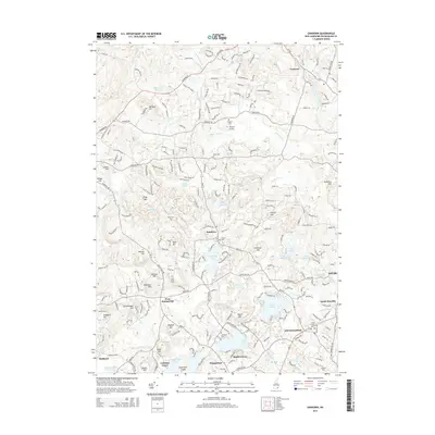
2015 Map of Sandown
USGS Topo · Published 2015About this map
The Exeter River flows through a landscape of glacial hills and numerous kettle ponds in this 2015 study of Rockingham County. The town of Sandown serves as a central hub, surrounded by smaller residential clusters including West Hampstead, South Danville, and Baglett Grove. The area’s topographical character is defined by named peaks such as Great Hill, King Hill, and Smith Mtn, which rise above a network of water bodies like Phillips Pond and Angle Pond. For genealogists and local historians, the map is a dense record of the region’s heritage, identifying nearly a dozen burial grounds including Wells Cem, Center Cem, and Lakeview Cem. The presence of Heaton Airport and major corridors like RT 121 and RT 111 illustrate the modern transportation framework laid over the historic village layouts of Fremont and Hampstead.
Find a feature on this map
67 named features on this map. Tap any name to fly to it.
Don’t see what you’re looking for? This feature index may not catch every label — zoom into the map to look around manually.
Map Details
Editions of this 2015 Sandown Map
This is the sole edition of this map. No revisions or reprints were ever made.
Other maps of this area

1888 · Haverhill
USGS Topo · 1:62,500

1890 · Haverhill
USGS Topo · 1:62,500

1893 · Haverhill
USGS Topo · 1:62,500

1905 · Manchester
USGS Topo · 1:62,500

1917 · Mt. Pawtuckaway
USGS Topo · 1:62,500

1919 · Mt. Pawtuckaway
USGS Topo · 1:62,500

1921 · Suncook
USGS Topo · 1:62,500

1935 · Haverhill
USGS Topo · 1:62,500

1939 · Mt. Pawtuckaway
USGS Topo · 1:62,500

1941 · Manchester
USGS Topo · 1:62,500