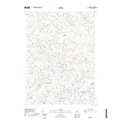
2018 Map of Sandown
USGS Topo · Published 2018About this map
Sandown and the surrounding Rockingham County landscape are defined by a complex network of glacial ponds and family-named hills. The Exeter River meanders through the northern reaches near Fremont, while larger water bodies like Phillips Pond and Angle Pond anchor the southern settlements. For genealogists and local historians, this map preserves the locations of numerous historic burial grounds, including the Sanborn Cem, Wells Cem, and the Old Cem near Hampstead. The area's topography is marked by significant elevations such as Mardens Hill, Hoyt Hill, and Smith Mtn, which have historically shaped the development of local roads and property boundaries. A notable modern landmark, the New Poverty Flats Airport, sits centrally among these older settlements. The map details the transition from traditional village centers like West Hampstead to the more dispersed residential patterns found near Big Island Pond and Governors Island at the turn of the 21st century.
Find a feature on this map
230 named features on this map. Tap any name to fly to it.
Don’t see what you’re looking for? This feature index may not catch every label — zoom into the map to look around manually.
Map Details
Editions of this 2018 Sandown Map
This is the sole edition of this map. No revisions or reprints were ever made.
Other maps of this area

1888 · Haverhill
USGS Topo · 1:62,500

1890 · Haverhill
USGS Topo · 1:62,500

1893 · Haverhill
USGS Topo · 1:62,500

1905 · Manchester
USGS Topo · 1:62,500

1917 · Mt. Pawtuckaway
USGS Topo · 1:62,500

1919 · Mt. Pawtuckaway
USGS Topo · 1:62,500

1921 · Suncook
USGS Topo · 1:62,500

1935 · Haverhill
USGS Topo · 1:62,500

1939 · Mt. Pawtuckaway
USGS Topo · 1:62,500

1941 · Manchester
USGS Topo · 1:62,500