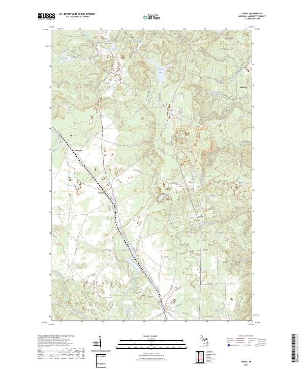
2023 Map of Sands
USGS Topo · Published 2023About this map
Harvey and the surrounding township of Sands are situated within a landscape shaped by significant glacial features and water systems in Michigan's Upper Peninsula. The terrain is defined by the Kona Hills and Ragged Hills to the northwest, with the Migisy Bluff overlooking the northeastern drainage towards Carp River Lake. This 2023 edition shows a modern network of local roads and recreational paths, including the Blueberry Ridge Pathway Trl, which winds through the central forested sections near Strawberry Lake. Settlement patterns follow the corridor of roads like Co RD 480, linking older locations such as Gentian and Cascade with newer residential development near the lakes. The intricate hydrography includes numerous small bodies of water like Uncle Tom Lake, Powell Lake, and Peterson Creek, illustrating the well-watered character of this Marquette County landscape. This survey provides a precise account of the modern interface between outdoor recreation areas and residential expansion.
Find a feature on this map
86 named features on this map. Tap any name to fly to it.
Don’t see what you’re looking for? This feature index may not catch every label — zoom into the map to look around manually.
Map Details
Editions of this 2023 Sands Map
This is the sole edition of this map. No revisions or reprints were ever made.
Other maps of this area

1907 · Marquette
USGS Topo · 1:62,500

1932 · Harvey NW
USGS Topo · 1:31,680

1932 · Harvey SE
USGS Topo · 1:31,680

1932 · Harvey SW
USGS Topo · 1:31,680

1932 · Harvey NE
USGS Topo · 1:31,680

1952 · Sands
USGS Topo · 1:24,000

1952 · Ishpeming
USGS Topo · 1:62,500

1952 · Gwinn
USGS Topo · 1:62,500

1952 · Palmer
USGS Topo · 1:24,000

1952 · Gwinn
USGS Topo · 1:24,000