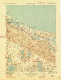
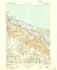
1943 Map of Sandwich
USGS Topo · Published 1948About this map
Cape Cod Bay defines the northern edge of this Barnstable County study, where the Cape Cod Canal enters the sea near Town Neck. The landscape transitions from the coastal Great Marshes and Springhill Beach to the interior's dense concentration of kettle ponds, including Lawrence Pond and Wakeby Pond. The historic rail presence of the New York New Haven and Hartford line connects the established settlements of Sandwich and East Sandwich, tracing the northern corridor just inland from the marshes.
Find a feature on this map
104 named features on this map. Tap any name to fly to it.
Don’t see what you’re looking for? This feature index may not catch every label — zoom into the map to look around manually.
Map Details
Editions of this 1943 Sandwich Map
5 editions found
Other maps of this area

1886 · Falmouth
USGS Topo · 1:62,500

1886 · Plymouth
USGS Topo · 1:62,500

1888 · Barnstable
USGS Topo · 1:62,500

1888 · Falmouth
USGS Topo · 1:62,500

1889 · Plymouth
USGS Topo · 1:62,500

1893 · Barnstable
USGS Topo · 1:62,500

1893 · Falmouth
USGS Topo · 1:62,500

1894 · Plymouth
USGS Topo · 1:62,500

1915 · Falmouth
USGS Topo · 1:62,500

1920 · Falmouth
USGS Topo · 1:62,500