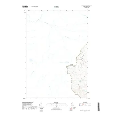
2018 Map of Sandy Bay Mountain
USGS Topo · Published 2018About this map
The international border between Canada and the United States defines this high-latitude terrain, where the headwaters of major river systems originate from glacial lakes. The topography is dominated by Sandy Bay Mountain in the southeast, a significant peak that overlooks the drainage divide between the Atlantic and St. Lawrence watersheds. To the north and west of the boundary, the landscape is a network of Canadian waterways including Rivière du Loup, Rivière du Monument, and several ponds such as Lac Whisky and Lac Jolin. In the American sector, the terrain drops toward the S Br Penobscot River and W Br Sandy Stream. A modern corridor follows the border, marked by the Alt Main Trl and Powerline Rd, illustrating how utility and transport infrastructure often parallels national boundaries in remote woodland regions.
Find a feature on this map
16 named features on this map. Tap any name to fly to it.
Don’t see what you’re looking for? This feature index may not catch every label — zoom into the map to look around manually.
Map Details
Editions of this 2018 Sandy Bay Mountain Map
This is the sole edition of this map. No revisions or reprints were ever made.
Other maps of this area

1923 · Attean
USGS Topo · 1:62,500

1925 · Attean
USGS Topo · 1:62,500

1927 · Sandy Bay
USGS Topo · 1:48,000

1928 · Skinner
USGS Topo · 1:48,000

1930 · Sandy Bay
USGS Topo · 1:62,500

1931 · Skinner
USGS Topo · 1:62,500

1944 · Sandy Bay
USGS Topo · 1:62,500

1949 · Jackman
USGS Topo · 1:250,000

1950 · Attean
USGS Topo · 1:50,000

1963 · Jackman
USGS Topo · 1:250,000