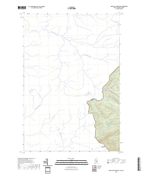
2024 Map of Sandy Bay Mountain
USGS Topo · Published 2024About this map
The Canada Usa international boundary defines the eastern reach of this Somerset County landscape, where the high peaks of Sandy Bay Mountain overlook a complex network of northern waterways. The terrain is a watershed for several significant drainages, including the headwaters of the South Branch Penobscot River and the French-named Rivière du Loup. Transportation through these woods is limited to seasonal routes like the Alt Main Trl and Campbell Pond Rd, reflecting the area's primary use for timber and outdoor recreation. A distinctive cluster of lakes, including Lac du Monument, Lac Jolin, and the curiously named Lac Whisky, are scattered across the northwestern quadrant, linked by smaller streams such as Ruisseau Caouette and Ruisseau Laurison. This cartographic survey provides a modern look at how the Maine wilderness interfaces with its northern neighbor through shared hydrography like the Rivière du Monument.
Find a feature on this map
14 named features on this map. Tap any name to fly to it.
Don’t see what you’re looking for? This feature index may not catch every label — zoom into the map to look around manually.
Map Details
Editions of this 2024 Sandy Bay Mountain Map
This is the sole edition of this map. No revisions or reprints were ever made.
Other maps of this area

1923 · Attean
USGS Topo · 1:62,500

1925 · Attean
USGS Topo · 1:62,500

1927 · Sandy Bay
USGS Topo · 1:48,000

1928 · Skinner
USGS Topo · 1:48,000

1930 · Sandy Bay
USGS Topo · 1:62,500

1931 · Skinner
USGS Topo · 1:62,500

1944 · Sandy Bay
USGS Topo · 1:62,500

1949 · Jackman
USGS Topo · 1:250,000

1950 · Attean
USGS Topo · 1:50,000

1963 · Jackman
USGS Topo · 1:250,000