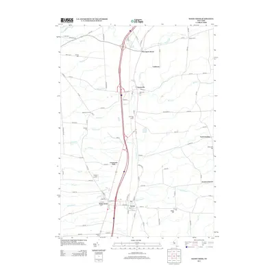
2013 Map of Sandy Creek
USGS Topo · Published 2013About this map
Sandy Creek and Lacona serve as the primary residential hubs in this northern New York landscape, situated along a transportation corridor that includes Interstate 81. The area is defined by a dense network of tributaries including Little Sandy Cr, Lindsey Cr, and Skinner Cr, which drain westward toward Lake Ontario. Significant genealogical resources are scattered throughout the region, from Union Cem near the village center to more isolated sites like Brewster Cem and Scripture Cem.
Find a feature on this map
96 named features on this map. Tap any name to fly to it.
Don’t see what you’re looking for? This feature index may not catch every label — zoom into the map to look around manually.
Map Details
Editions of this 2013 Sandy Creek Map
This is the sole edition of this map. No revisions or reprints were ever made.
Other maps of this area

1893 · Sackets Harbor
USGS Topo · 1:62,500

1895 · Sacketts Harbor
USGS Topo · 1:62,500

1895 · Pulaski
USGS Topo · 1:62,500

1895 · Watertown
USGS Topo · 1:62,500

1898 · Watertown
USGS Topo · 1:62,500

1903 · Orwell
USGS Topo · 1:62,500

1905 · Orwell
USGS Topo · 1:62,500

1908 · Watertown
USGS Topo · 1:62,500

1909 · Watertown
USGS Topo · 1:62,500

1942 · Sandy Creek
USGS Topo · 1:24,000