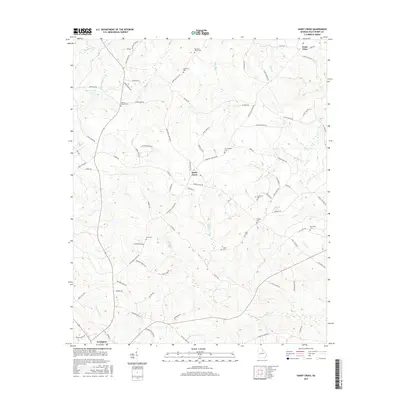
2017 Map of Sandy Cross
USGS Topo · Published 2017About this map
Sandy Cross serves as a central hub for this rural stretch of Oglethorpe County, where the landscape is defined by the winding paths of Clouds Creek and Millstone Creek. This 2017 survey reveals a deeply rooted community, evidenced by the high concentration of family cemeteries such as Jarrell - Howard Cem, Paul and Lester Cem, and McCannon Cem. These sites, often located near private farm roads like Watkins Farm Rd or Echols Rd, provide essential data for genealogists tracing long-standing local lineages.
Find a feature on this map
86 named features on this map. Tap any name to fly to it.
Don’t see what you’re looking for? This feature index may not catch every label — zoom into the map to look around manually.
Map Details
Editions of this 2017 Sandy Cross Map
This is the sole edition of this map. No revisions or reprints were ever made.
Other maps of this area

1891 · Carnesville
USGS Topo · 1:125,000

1893 · Elberton
USGS Topo · 1:125,000

1906 · Crawfordville
USGS Topo · 1:125,000

1953 · Athens
USGS Topo · 1:250,000

1954 · Greenville
USGS Topo · 1:250,000

1958 · Greenville
USGS Topo · 1:250,000

1958 · Athens
USGS Topo · 1:250,000

1958 · Danielsville
USGS Topo · 1:62,500

1958 · Elberton
USGS Topo · 1:62,500

1959 · Athens
USGS Topo · 1:250,000