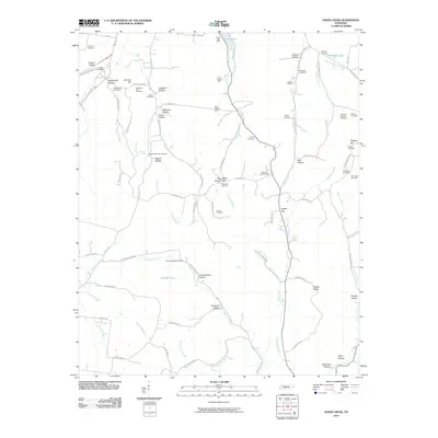
2010 Map of Sandy Hook
USGS Topo · Published 2010About this map
Mining operations and family burial grounds define the landscape of this Giles County region as it appeared in the early 21st century. The northern reaches show signs of industrial activity at the Arrow Lake Mine and Kittrell Mine, while the central hills are marked by the Ward-Gilliam Mine and Gilliam Mine. This map is a significant resource for genealogists, as it preserves the locations of numerous small family cemeteries scattered across the hollows, such as the Bumpass-King Cemetery near Johnson Hill and the Stone Cemetery off Dry Creek Rd. The terrain is characterized by complex drainage patterns, with Scotts Creek and Anderson Creek carving deep hollows like Pickard Hollow and Cantrell Hollow. Further south, the map details the rural infrastructure around Jonestown Rd and the quiet waters of Painter Pond.
Find a feature on this map
94 named features on this map. Tap any name to fly to it.
Don’t see what you’re looking for? This feature index may not catch every label — zoom into the map to look around manually.
Map Details
Editions of this 2010 Sandy Hook Map
This is the sole edition of this map. No revisions or reprints were ever made.
Other maps of this area

1901 · Colombia
USGS Topo · 1:125,000

1936 · Sandy Hook
USGS Topo · 1:24,000

1936 · Mt Joy
USGS Topo · 1:24,000

1936 · Milky Way
USGS Topo · 1:24,000

1936 · Campbellsville
USGS Topo · 1:24,000

1936 · Ethridge
USGS Topo · 1:24,000

1936 · Crestview
USGS Topo · 1:24,000

1936 · Mount Pleasant
USGS Topo · 1:24,000

1936 · Columbia
USGS Topo · 1:24,000

1936 · Lynnville
USGS Topo · 1:24,000