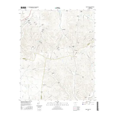
2016 Map of Sandy Hook
USGS Topo · Published 2016About this map
Jonestown and Sandy Hook anchor this landscape where Maury, Lawrence, and Giles counties meet. The terrain is characterized by a dense network of hollows and ridges, such as Pickard Hollow and Nubbin Ridge, which dictate the winding paths of rural routes like Dry Creek RD and Elk Ridge RD. This geography has fostered several small, distinct communities including Enterprise and Screamer, each situated within the complex drainage basins of Big Bigby Cr and Sugar Cr.
Find a feature on this map
114 named features on this map. Tap any name to fly to it.
Don’t see what you’re looking for? This feature index may not catch every label — zoom into the map to look around manually.
Map Details
Editions of this 2016 Sandy Hook Map
This is the sole edition of this map. No revisions or reprints were ever made.
Other maps of this area

1901 · Colombia
USGS Topo · 1:125,000

1936 · Sandy Hook
USGS Topo · 1:24,000

1936 · Mt Joy
USGS Topo · 1:24,000

1936 · Milky Way
USGS Topo · 1:24,000

1936 · Campbellsville
USGS Topo · 1:24,000

1936 · Ethridge
USGS Topo · 1:24,000

1936 · Crestview
USGS Topo · 1:24,000

1936 · Mount Pleasant
USGS Topo · 1:24,000

1936 · Columbia
USGS Topo · 1:24,000

1936 · Lynnville
USGS Topo · 1:24,000