
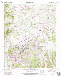
1936 Map of Sandy Hook
USGS Topo · Published 1936About this map
Sandy Hook and Enterprise serve as focal points for this 1936 survey of the rolling borderlands where Maury, Giles, and Lawrence Counties meet. The landscape is defined by the high divide of Elk Ridge, separating the drainage of Bigby Creek and Dry Creek in the north from the Anderson Creek watershed to the south. A notable industrial presence is indicated by the L and N RR and a narrow gage rail line near Arrow Lake, alongside infrastructure like a flume and T E P Co Trans Line.
Find a feature on this map
54 named features on this map. Tap any name to fly to it.
Don’t see what you’re looking for? This feature index may not catch every label — zoom into the map to look around manually.
Map Details
Editions of this 1936 Sandy Hook Map
This is the sole edition of this map. No revisions or reprints were ever made.
Other maps of this area

1901 · Colombia
USGS Topo · 1:125,000

1936 · Mt Joy
USGS Topo · 1:24,000

1936 · Milky Way
USGS Topo · 1:24,000

1936 · Campbellsville
USGS Topo · 1:24,000

1936 · Ethridge
USGS Topo · 1:24,000

1936 · Crestview
USGS Topo · 1:24,000

1936 · Mount Pleasant
USGS Topo · 1:24,000

1936 · Columbia
USGS Topo · 1:24,000

1936 · Lynnville
USGS Topo · 1:24,000
1946 · Mount Pleasant
USGS Topo · 1:24,000