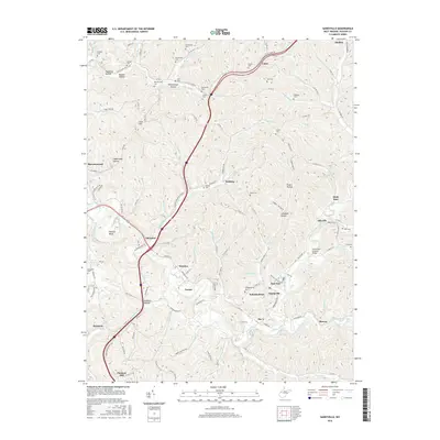
2016 Map of Sandyville
USGS Topo · Published 2016About this map
The Sarvis Fork Covered Bridge serves as a prominent historical landmark in this region of Jackson County, situated near the intersection of Old Us HWY 21 and Sarvis Fork. The landscape is defined by a dense network of small communities and rural family homesteads, including Silverton, Sandyville, and Odaville. The educational history of the area is represented by the Silverton Red Bush School, while numerous small burial grounds such as Beckwith Cem, Independence Cem, and Nesselroad Cem provide significant touchpoints for genealogical research. The terrain is deeply dissected by drainages like Sandy Creek and Little Sandy Cr, creating named features such as Polecat Bend and Wolfpen Hollow. Higher elevations are marked by Crow Summit and Utah Hill, providing a comprehensive look at the rural West Virginia interior during the mid-2010s.
Find a feature on this map
137 named features on this map. Tap any name to fly to it.
Don’t see what you’re looking for? This feature index may not catch every label — zoom into the map to look around manually.
Map Details
Editions of this 2016 Sandyville Map
This is the sole edition of this map. No revisions or reprints were ever made.
Other maps of this area

1906 · Belleville
USGS Topo · 1:62,500

1907 · Keno
USGS Topo · 1:62,500

1907 · Ripley
USGS Topo · 1:62,500

1908 · Ravenswood
USGS Topo · 1:62,500

1924 · Belleville
USGS Topo · 1:62,500

1926 · Ravenswood
USGS Topo · 1:62,500

1926 · Belleville
USGS Topo · 1:62,500

1926 · Ripley
USGS Topo · 1:62,500

1928 · Ravenswood
USGS Topo · 1:62,500

1928 · Ripley
USGS Topo · 1:62,500