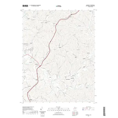
2019 Map of Sandyville
USGS Topo · Published 2019About this map
The Sarvis Fork Covered Bridge spans a quiet tributary in Jackson County, serving as a distinct focal point for this landscape of high ridges and deep hollows. The settlement pattern here is dictated by the rugged topography of the Left Fork Sandy Creek and its many branches, with communities like Sandyville and Silverton established at key drainage junctions. Genealogists will find a significant density of family-named burial grounds across the hills, including Safreed Cem, Nesselroad Cem, and the Springston Cem. The presence of the Silverton-Red Bush School and several rural churches underscores the enduring social fabric of these valley settlements. Landforms with descriptive local names like Polecat Bend, Deadman Hollow, and Utah Hill illustrate how the early inhabitants identified and navigated this complex terrain.
Find a feature on this map
147 named features on this map. Tap any name to fly to it.
Don’t see what you’re looking for? This feature index may not catch every label — zoom into the map to look around manually.
Map Details
Editions of this 2019 Sandyville Map
This is the sole edition of this map. No revisions or reprints were ever made.
Other maps of this area

1906 · Belleville
USGS Topo · 1:62,500

1907 · Keno
USGS Topo · 1:62,500

1907 · Ripley
USGS Topo · 1:62,500

1908 · Ravenswood
USGS Topo · 1:62,500

1924 · Belleville
USGS Topo · 1:62,500

1926 · Ravenswood
USGS Topo · 1:62,500

1926 · Belleville
USGS Topo · 1:62,500

1926 · Ripley
USGS Topo · 1:62,500

1928 · Ravenswood
USGS Topo · 1:62,500

1928 · Ripley
USGS Topo · 1:62,500