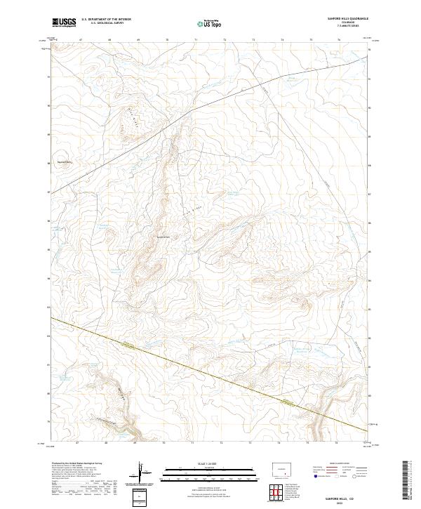
2022 Map of Sanford Hills
USGS Topo · Published 2022About this map
Sanford Hills rises from the high plains of southern Colorado, marking a transition between the elevated peaks and the canyon-cut lowlands. The landscape is defined by its water management, centered around a series of ranching and irrigation catchments including Davis Reservoir, Buffalo Arroyo Reservoir, and Rock Dam Reservoir. These small-scale water sources are essential to life in this semi-arid region, supporting livestock and local agriculture where drainage systems like Saunders Arroyo and Twomile Arroyo carve paths through the terrain.
Find a feature on this map
27 named features on this map. Tap any name to fly to it.
Don’t see what you’re looking for? This feature index may not catch every label — zoom into the map to look around manually.
Map Details
Editions of this 2022 Sanford Hills Map
This is the sole edition of this map. No revisions or reprints were ever made.
Other maps of this area

1891 · Apishapa
USGS Topo · 1:125,000

1893 · Apishapa
USGS Topo · 1:125,000

1897 · Apishapa
USGS Topo · 1:125,000

1954 · Trinidad
USGS Topo · 1:250,000

1955 · Trinidad
USGS Topo · 1:250,000

1958 · Trinidad
USGS Topo · 1:250,000

1959 · Trinidad
USGS Topo · 1:250,000
1970 · Red Top Ranch
USGS Topo · 1:24,000
1970 · Apishapa Bridge
USGS Topo · 1:24,000
1970 · Snowden Lake
USGS Topo · 1:24,000