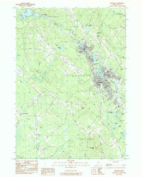
1983 Map of Sanford
USGS Topo · Published 1984About this map
The Mousam River corridor anchors the urban development of Sanford and Springvale in this early 1980s landscape. The map captures a high density of civic and educational institutions, including Nasson College, the Goodall Mem Hosp, and numerous schools such as St Thomas Sch and Lincoln Sch. Local industry is evidenced by several Sand and Gravel operations and the central municipal infrastructure like the Town Hall and Fed Bldg.
Find a feature on this map
79 named features on this map. Tap any name to fly to it.
Don’t see what you’re looking for? This feature index may not catch every label — zoom into the map to look around manually.
Map Details
Editions of this 1983 Sanford Map
2 editions found
Other maps of this area

1891 · Berwick
USGS Topo · 1:62,500

1891 · Kennebunk
USGS Topo · 1:62,500

1891 · Buxton
USGS Topo · 1:62,500

1891 · Newfield
USGS Topo · 1:62,500

1892 · Buxton
USGS Topo · 1:62,500

1893 · Kennebunk
USGS Topo · 1:62,500

1893 · Berwick
USGS Topo · 1:62,500

1893 · Buxton
USGS Topo · 1:62,500

1893 · Newfield
USGS Topo · 1:62,500

1898 · Kennebunk
USGS Topo · 1:62,500