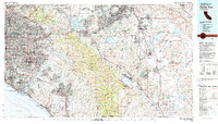
1983 Map of Santa Ana
USGS Topo · Published 1983About this map
The Santa Ana Mountains form a central divide in this 1983 survey, separating the dense coastal developments of Orange County from the expanding inland communities of Riverside County. Major military installations, including March Air Force Base and El Toro Marine Corps Air Station, anchor the regional infrastructure alongside institutional landmarks like the California Institution for Men and the Univ of Calif Irvine. The map captures a landscape defined by water management and resource extraction, from the Prado Flood Control Basin to historical industrial sites like the Santiago Coal Mine and Good Hope Mine. Significant terrain features such as Santiago Peak and The Badlands provide contrast to the sprawling residential footprints of Mission Viejo and Riverside. This era reflects a complex network of major transit corridors like the Santa Ana Fwy and Riverside Fwy threading through the Cleveland National Forest.
Find a feature on this map
150 named features on this map. Tap any name to fly to it.
Don’t see what you’re looking for? This feature index may not catch every label — zoom into the map to look around manually.
Map Details
Editions of this 1983 Santa Ana Map
This is the sole edition of this map. No revisions or reprints were ever made.
Other maps of this area

1894 · Los Angeles
USGS Topo · 1:62,500

1894 · Pomona
USGS Topo · 1:62,500

1896 · Santa Ana
USGS Topo · 1:62,500

1896 · Pasadena
USGS Topo · 1:62,500

1896 · Anaheim
USGS Topo · 1:62,500

1896 · San Bernardino
USGS Topo · 1:62,500

1896 · Las Bolsas
USGS Topo · 1:62,500

1896 · Downey
USGS Topo · 1:62,500

1897 · Pomona
USGS Topo · 1:62,500

1897 · Cucamonga
USGS Topo · 1:62,500