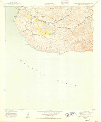
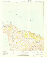
1950 Map of Santa Catalina South
USGS Topo · Published 1950About this map
Middle Ranch serves as a central point of activity within the island's interior, situated near the head of Middle Canyon. This 1950 survey by the Army Map Service details a landscape defined by sharp drainage systems and significant elevations, including Mt Banning and Cactus Peak. The mapping of Thompson Dam indicates early water management efforts to support the ranch and local infrastructure in this part of Los Angeles County.
Find a feature on this map
17 named features on this map. Tap any name to fly to it.
Don’t see what you’re looking for? This feature index may not catch every label — zoom into the map to look around manually.
Map Details
Editions of this 1950 Santa Catalina South Map
This is the sole edition of this map. No revisions or reprints were ever made.
Other maps of this area

1943 · Santa Catalina North
USGS Topo · 1:24,000

1943 · Santa Catalina East
USGS Topo · 1:24,000

1943 · Santa Catalina South
USGS Topo · 1:24,000
1943 · Santa Catalina West
USGS Topo · 1:24,000

1949 · Long Beach
USGS Topo · 1:250,000
1950 · Santa Catalina West
USGS Topo · 1:24,000
1950 · Santa Catalina East
USGS Topo · 1:24,000
1950 · Santa Catalina North
USGS Topo · 1:24,000

1957 · Long Beach
USGS Topo · 1:250,000

1958 · Long Beach
USGS Topo · 1:250,000