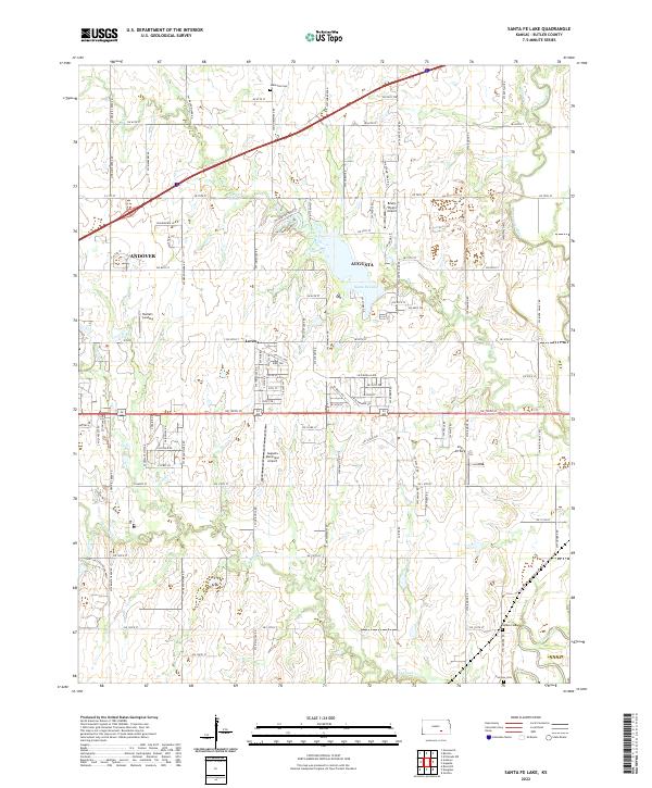
2022 Map of Santa Fe Lake
USGS Topo · Published 2022About this map
Santa Fe Lake serves as a central geographic feature in this part of Butler County, where the plains of Kansas are etched by the Whitewater River and the Walnut River. The landscape reflects a well-ordered township system where rural life intersects with regional aviation, evidenced by three distinct landing strips: Augusta Municipal Airport, Brady-Pippin Airport, and Sills Air Park. For those tracing local history, several small burial grounds such as Indianola Cem and Golden Cem are documented alongside the settlement at Lorena. The road network, including names like SW Frontier Trail St and SW Overland Trail St, preserves the memory of historical transit routes across the prairie. The proximity of Andover and Augusta highlights the area's role as a suburban and agricultural hub east of Wichita.
Find a feature on this map
99 named features on this map. Tap any name to fly to it.
Don’t see what you’re looking for? This feature index may not catch every label — zoom into the map to look around manually.
Map Details
Editions of this 2022 Santa Fe Lake Map
This is the sole edition of this map. No revisions or reprints were ever made.
Other maps of this area

1888 · Eldorado
USGS Topo · 1:125,000

1889 · Wichita
USGS Topo · 1:125,000

1894 · Wichita
USGS Topo · 1:125,000

1945 · Andover
USGS Topo · 1:31,680

1955 · Santa Fe Lake
USGS Topo · 1:24,000

1955 · Benton
USGS Topo · 1:24,000

1955 · Greenwich
USGS Topo · 1:24,000

1955 · Rose Hill
USGS Topo · 1:24,000

1955 · Douglass
USGS Topo · 1:24,000

1955 · Wichita
USGS Topo · 1:250,000