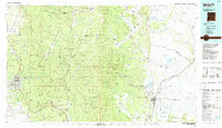
1983 Map of Santa Fe
USGS Topo · Published 1984About this map
Santa Fe and the high mountain corridor of the Sangre de Cristo Mountains dominate this 1980s landscape, illustrating the proximity of urban development to the vast Santa Fe National Forest. The map captures the infrastructure of the era, from the sprawl around the College of Santa Fe and the Santa Fe Municipal Airport to the critical transportation artery of the Atchison Topeka and Santa Fe RR as it winds through Glorieta Pass. Historic pueblo lands like Nambe Pueblo and Tesuque sit alongside newer rural settlements such as Chupadero and En Medio.
Find a feature on this map
202 named features on this map. Tap any name to fly to it.
Don’t see what you’re looking for? This feature index may not catch every label — zoom into the map to look around manually.
Map Details
Editions of this 1983 Santa Fe Map
This is the sole edition of this map. No revisions or reprints were ever made.
Other maps of this area

1889 · Las Vegas
USGS Topo · 1:125,000

1889 · Santa Fe
USGS Topo · 1:125,000

1890 · Bernal
USGS Topo · 1:125,000

1891 · Bernal
USGS Topo · 1:125,000

1891 · Las Vegas
USGS Topo · 1:125,000

1892 · San Pedro
USGS Topo · 1:125,000

1892 · Santa Clara
USGS Topo · 1:125,000

1892 · Watrous
USGS Topo · 1:125,000

1892 · Corazon
USGS Topo · 1:125,000

1893 · Las Vegas
USGS Topo · 1:125,000