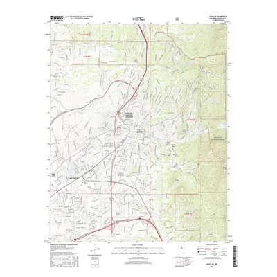
2017 Map of Santa Fe
USGS Topo · Published 2017About this map
Santa Fe dominates this high-altitude landscape, where the foothills of the Santa Fe National Forest meet the arterial roads of the Rio Grande valley. The city's layout is shaped by numerous arroyos, including Arroyo Mascaras and Arroyo Gallinas, which drain toward the Santa Fe River. Significant historical and cultural markers are dense within the urban area, such as the Bridge of the Hidalgos Historic Site and several significant burial grounds like Rosario Cem and the expansive Santa Fe National Cemetery.
Find a feature on this map
78 named features on this map. Tap any name to fly to it.
Don’t see what you’re looking for? This feature index may not catch every label — zoom into the map to look around manually.
Map Details
Editions of this 2017 Santa Fe Map
This is the sole edition of this map. No revisions or reprints were ever made.
Other maps of this area

1889 · Santa Fe
USGS Topo · 1:125,000

1892 · Santa Clara
USGS Topo · 1:125,000

1894 · Santa Fe
USGS Topo · 1:125,000

1951 · Agua Fria
USGS Topo · 1:24,000

1951 · Turquoise Hill
USGS Topo · 1:24,000

1952 · Santa Fe
USGS Topo · 1:24,000

1952 · Turquoise Hill
USGS Topo · 1:24,000

1952 · Seton Village
USGS Topo · 1:24,000

1953 · Tesuque
USGS Topo · 1:24,000

1953 · Horcado Ranch
USGS Topo · 1:24,000