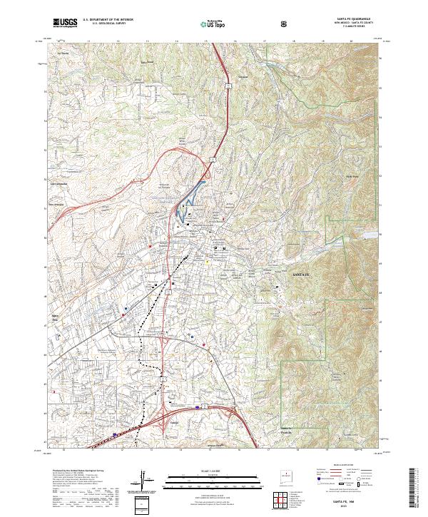
2023 Map of Santa Fe
USGS Topo · Published 2023About this map
Santa Fe is captured here in 2023, showing the high-desert capital city where it meets the western slopes of the Santa Fe National Forest. The map documents a complex network of arroyos, including Arroyo de los Lovatos and Arroyo Mascaras, which channel seasonal runoff toward the Santa Fe River. This topography defines the modern urban layout, with residential developments like La Tierra and Las Campanas expanding into the rugged foothills.
Find a feature on this map
77 named features on this map. Tap any name to fly to it.
Don’t see what you’re looking for? This feature index may not catch every label — zoom into the map to look around manually.
Map Details
Editions of this 2023 Santa Fe Map
This is the sole edition of this map. No revisions or reprints were ever made.
Other maps of this area

1889 · Santa Fe
USGS Topo · 1:125,000

1892 · Santa Clara
USGS Topo · 1:125,000

1894 · Santa Fe
USGS Topo · 1:125,000

1951 · Agua Fria
USGS Topo · 1:24,000

1951 · Turquoise Hill
USGS Topo · 1:24,000

1952 · Santa Fe
USGS Topo · 1:24,000

1952 · Turquoise Hill
USGS Topo · 1:24,000

1952 · Seton Village
USGS Topo · 1:24,000

1953 · Tesuque
USGS Topo · 1:24,000

1953 · Horcado Ranch
USGS Topo · 1:24,000