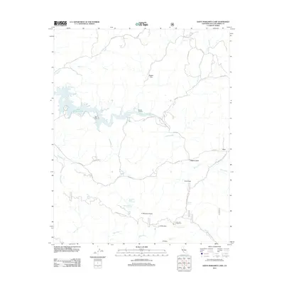
2012 Map of Santa Margarita Lake
USGS Topo · Published 2012About this map
Santa Margarita Lake serves as a primary geographic focus in this interior San Luis Obispo County landscape, where the waters are fed by the Salinas River and numerous mountain creeks. The settlement pattern is sparse, defined by the small community of Pozo and the crossroads at Pippin Corner. The surrounding terrain transitions from the alluvial spaces of Magetti Flats and Vaca Flat into the elevated heights of Hi Mountain. This area is marked by a network of historical transit routes and resource management trails, including W Pozo Rd and the Hi Mountain Lookout Rd. Genealogists and local historians can trace the locations of specific water sources like McNeil Spring and Salsipuedes Spring Number One, alongside recreational landmarks such as the Hi Mountain Campground.
Find a feature on this map
40 named features on this map. Tap any name to fly to it.
Don’t see what you’re looking for? This feature index may not catch every label — zoom into the map to look around manually.
Map Details
Editions of this 2012 Santa Margarita Lake Map
This is the sole edition of this map. No revisions or reprints were ever made.
Other maps of this area

1897 · San Luis Obispo
USGS Topo · 1:62,500

1897 · Arroyo Grande
USGS Topo · 1:62,500

1900 · San Luis
USGS Topo · 1:125,000

1922 · Pozo
USGS Topo · 1:62,500

1922 · Nipomo
USGS Topo · 1:62,500

1942 · San Luis Obispo
USGS Topo · 1:62,500

1942 · Arroyo Grande
USGS Topo · 1:62,500

1947 · San Luis Obispo
USGS Topo · 1:250,000

1948 · San Luis Obispo
USGS Topo · 1:250,000

1952 · Arroyo Grande
USGS Topo · 1:62,500