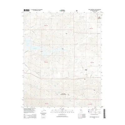
2015 Map of Santa Margarita Lake
USGS Topo · Published 2015About this map
Santa Margarita Lake and the winding Salinas River dominate this central California landscape, where the southern reaches of the Diablo Range meet the Los Padres National Forest. The small settlement of Pozo sits at the eastern edge of the map near the Pozo Creek and Salinas River junction, serving as a historic crossroads for the surrounding ranching and mountain country. The terrain is marked by steep canyons and prominent peaks like Garcia Mountain and Hi Mountain, with high-elevation potreros and flats such as Magetti Flats and Vaca Flat providing level ground amidst the ridges. Numerous springs, including Salsipuedes Spring Number One and McNeil Spring, indicate the vital water sources required for life in this arid, high-relief environment. Tracing the old paths like W Pozo Road and Old Rinconada Road reveals the traditional transit network connecting isolated homesteads to the river valley.
Find a feature on this map
42 named features on this map. Tap any name to fly to it.
Don’t see what you’re looking for? This feature index may not catch every label — zoom into the map to look around manually.
Map Details
Editions of this 2015 Santa Margarita Lake Map
This is the sole edition of this map. No revisions or reprints were ever made.
Other maps of this area

1897 · San Luis Obispo
USGS Topo · 1:62,500

1897 · Arroyo Grande
USGS Topo · 1:62,500

1900 · San Luis
USGS Topo · 1:125,000

1922 · Pozo
USGS Topo · 1:62,500

1922 · Nipomo
USGS Topo · 1:62,500

1942 · San Luis Obispo
USGS Topo · 1:62,500

1942 · Arroyo Grande
USGS Topo · 1:62,500

1947 · San Luis Obispo
USGS Topo · 1:250,000

1948 · San Luis Obispo
USGS Topo · 1:250,000

1952 · Arroyo Grande
USGS Topo · 1:62,500