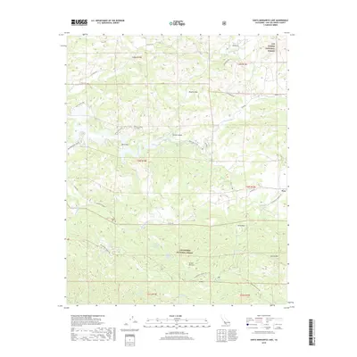
2018 Map of Santa Margarita Lake
USGS Topo · Published 2018About this map
The settlement of Pozo sits at the eastern edge of this territory, where the Salinas River carves through the interior of Los Padres National Forest. This 2018 survey reveals a landscape of high-elevation flats and canyons, including Vaca Flat and Magetti Flats, linked by old backcountry routes like the Blinn Ranch Trail. The area is defined by its water sources, with several named springs such as Salsipuedes Spring Number One, Salsipuedes Spring Number Two, and McNeil Spring providing critical points of interest for those studying the drainage patterns of Salsipuedes Creek.
Find a feature on this map
42 named features on this map. Tap any name to fly to it.
Don’t see what you’re looking for? This feature index may not catch every label — zoom into the map to look around manually.
Map Details
Editions of this 2018 Santa Margarita Lake Map
This is the sole edition of this map. No revisions or reprints were ever made.
Other maps of this area

1897 · San Luis Obispo
USGS Topo · 1:62,500

1897 · Arroyo Grande
USGS Topo · 1:62,500

1900 · San Luis
USGS Topo · 1:125,000

1922 · Pozo
USGS Topo · 1:62,500

1922 · Nipomo
USGS Topo · 1:62,500

1942 · San Luis Obispo
USGS Topo · 1:62,500

1942 · Arroyo Grande
USGS Topo · 1:62,500

1947 · San Luis Obispo
USGS Topo · 1:250,000

1948 · San Luis Obispo
USGS Topo · 1:250,000

1952 · Arroyo Grande
USGS Topo · 1:62,500