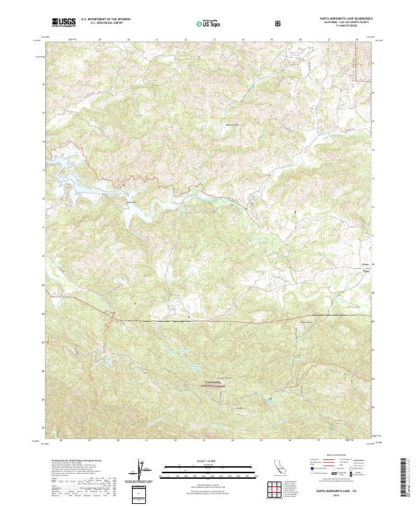
2021 Map of Santa Margarita Lake
USGS Topo · Published 2021About this map
Los Padres National Forest covers much of this landscape, where the southern reaches of the Salinas River carve through the coastal mountains of San Luis Obispo County. The settlement of Pozo sits at a crossroads in the east, serving as a gateway to the high country of the La Panza Range. The map reveals a sophisticated network of springs essential for life in this arid environment, including Hi Mountain Spring, McNeil Spring, and the two Salsipuedes Spring locations. Historical land use is visible in the named flats and potreros, such as Magetti Flats and Hi Mtn Potrero, which suggest seasonal grazing or homesteading sites. A complex system of trails, including the Big Falls Trl and Rinconada Trl, provides access to landmarks like Garcia Mtn and the canyons of Salsipuedes Cr.
Find a feature on this map
46 named features on this map. Tap any name to fly to it.
Don’t see what you’re looking for? This feature index may not catch every label — zoom into the map to look around manually.
Map Details
Editions of this 2021 Santa Margarita Lake Map
This is the sole edition of this map. No revisions or reprints were ever made.
Other maps of this area

1897 · San Luis Obispo
USGS Topo · 1:62,500

1897 · Arroyo Grande
USGS Topo · 1:62,500

1900 · San Luis
USGS Topo · 1:125,000

1922 · Pozo
USGS Topo · 1:62,500

1922 · Nipomo
USGS Topo · 1:62,500

1942 · San Luis Obispo
USGS Topo · 1:62,500

1942 · Arroyo Grande
USGS Topo · 1:62,500

1947 · San Luis Obispo
USGS Topo · 1:250,000

1948 · San Luis Obispo
USGS Topo · 1:250,000

1952 · Arroyo Grande
USGS Topo · 1:62,500